


le Banes-Sept Faux

yt34
User
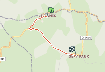

Length
2 km

Max alt
913 m

Uphill gradient
73 m
Km-Effort
2.9 km

Min alt
842 m

Downhill gradient
49 m
Boucle
No
Creation date :
2014-12-10 00:00:00.0
Updated on :
2014-12-10 00:00:00.0
--
Difficulty : Very easy

FREE GPS app for hiking
 SityTrail
IGN / Geographical institutes
SityTrail Plus
The world is yours!
About
Trail Walking of 2 km to be discovered at Occitania, Hérault, Le Soulié. This trail is proposed by yt34.
Description
Itinéraire Fours SOLHER 2012
Positioning
Country:
France
Region :
Occitania
Department/Province :
Hérault
Municipality :
Le Soulié
Location:
Unknown
Start:(Dec)
Start:(UTM)
470255 ; 4823646 (31T) N.
Comments
banrs sept taux